
Texarkana ZIP Coverage at a Glance
Only one current Arkansas-side Texarkana delivery ZIP is confirmed by the official sources reviewed for this project. That narrow result is useful. It prevents a ZIP code directory from presenting Texas-side codes as if they belonged to Miller County. State Line Avenue marks the key divide: an Arkansas parcel belongs in Arkansas and Miller County records, while a parcel across the avenue belongs to Texas and Bowie County records.
| ZIP | Arkansas area served | Post office | Search caution |
|---|---|---|---|
| 71854 | Texarkana, Arkansas delivery area | Downtown Texarkana, 500 N. State Line Avenue, Suite 101 | Postal city may extend beyond the incorporated city line |
No separate PO-box-only or unique code was verified for the Arkansas city. A responsible Texarkana postal directory should say so instead of filling a table with nearby codes. Texas 755xx codes are chiefly tied to the Texas side and should not be sent to Arkansas record offices without first checking the address itself.
Texarkana ZIP Codes Cross a Records Divide
Texarkana has an unusual records geography. The shared city name spans two incorporated cities, two states, and two counties. A postal result that says only “Texarkana” does not identify the proper assessor, recorder, court, or voter custodian. The full state and street location must do that work. On the Arkansas side, property and resident clues run through Miller County.
The downtown federal post office and courthouse makes the distinction vivid. The General Services Administration history says the 1931 building stands in the middle of State Line Avenue and is the only federal building sited in two states. At least twelve buildings were displaced or moved for its construction. The landmark serves both sides, but county deeds, local courts, and voter records still remain state-specific.
Verify a Texarkana ZIP First
Start with an official postal check. The USPS ZIP Code Lookup supports a city-and-state route as well as address-based verification. Enter the complete street address when one is known. A city-only lookup is broad, while the whole address helps catch a wrong state, incomplete directional, or old postal code before it sends the search to the wrong office.
The official USPS lookup screen below is the successful image assigned to this subject.
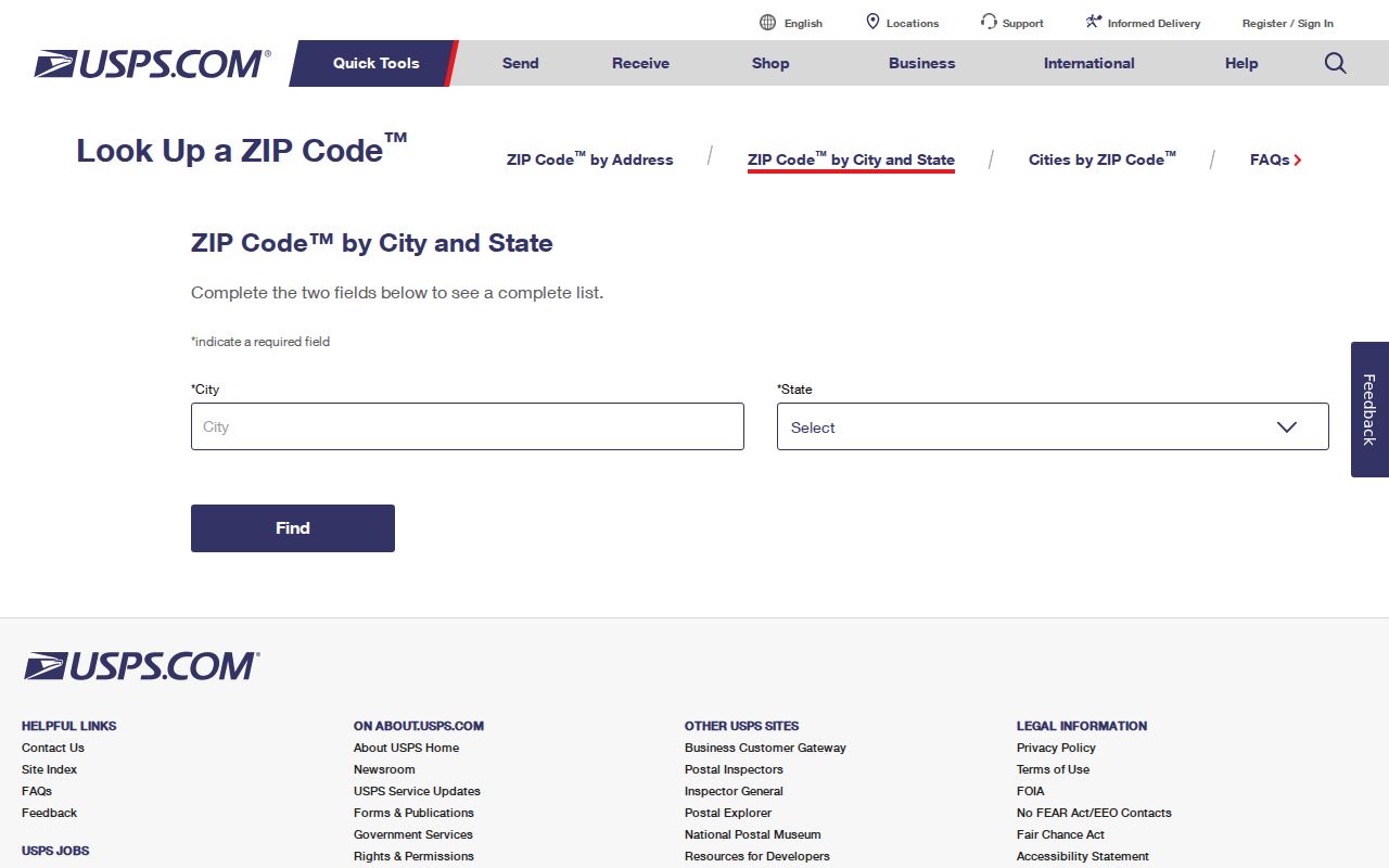
Use its answer as the postal starting point, then test the parcel and city boundary separately. A postal match does not prove that an address lies within Texarkana’s incorporated limits.
Find Texarkana Residents by ZIP
A ZIP-wide search works best as a funnel. Postal geography narrows the pool, but no single official Arkansas tool acts as a public list of everyone in that area. Property records identify owners, voter access follows its own rules, and city records depend on jurisdiction. Each source answers a different part of the question.
- Confirm the full address and Arkansas state designation through USPS.
- Check the address in Miller County ACT DataScout to locate the parcel, current listed owner, situs, and owner mailing address.
- Use DataScout OneMap to view the mapped parcel and nearby jurisdiction context.
- For a known voter, use VoterView with the required identity details. It does not allow public ZIP-wide browsing.
- When the task becomes street-specific, move to the Texarkana streets lookup and test addresses one at a time.
The Texarkana ZIP code directory is therefore an organizing layer, not a stand-alone resident roll. Confirm a name or owner through a second official source before treating two records as the same person.
Texarkana ZIP Property Search Fields
ACT DataScout does not expose a captured ZIP field in the research inventory. Its verified fields are still valuable after a postal code narrows the city. Search by the street address, owner, parcel number, or subdivision. That method is more exact than assuming every address sharing a mailing city sits inside the same legal boundary.
| Field | Input | Required | How it helps |
|---|---|---|---|
| Owner Name | Text | No | Tests a surname or business-name variant |
| Parcel Number | Text | No | Targets the county parcel identifier |
| Property Address | Text | No | Uses house number and street; abbreviation changes may matter |
| Subdivision | Text or dropdown | No | Groups parcels by recorded subdivision |
A parcel result may show the listed owner, mailing and situs addresses, legal description, lot or block, values, tax district, deed references, and a map link. Owner and occupant are not synonyms. The mailing address is where tax notices go; situs identifies the physical parcel.
Texarkana ZIP Versus City Limits
USPS delivery areas are not municipal boundaries. An address can keep the same mail routing while its city jurisdiction, ward, permit office, or services change. Arkansas GIS records document Texarkana annexations in 2007 under L314 and in 2017 under Ordinance 34-2017. Those changes matter when comparing an older record with a current parcel.
After the postal check, use Arkansas Check My City for municipal status and OneMap for parcel location. If the sources disagree or an older document uses a different postal convention, rely on the legal description and ask the correct custodian to confirm jurisdiction.
Boundary rule. A Texarkana mailing label is not proof that Miller County or the Arkansas city holds the record.
Old Texarkana ZIP Records Need Context
Historical records do not always show today’s postal code. Federal Boundary and Annexation Survey correspondence addressed Arkansas city officials as “Texarkana ARK 75502” in the 1970s. Current Arkansas-side mail uses 71854, but the research did not locate an authoritative USPS source for the exact conversion year. That gap should remain a gap.
For an old deed, directory entry, photograph, or family paper, search the recorded street, the Arkansas or Texas notation, and the legal description rather than forcing the modern code onto it. Test “Texarkana, Ark.” and “Texarkana, Tex.” in older indexes. A metropolitan directory may mix both sides even though deeds and court records do not share a custodian.
Note: No verified citywide street-renumbering or exact ZIP-conversion year was found, so legal descriptions provide the safer bridge across time.
How Texarkana 911 Addresses Work
Miller County’s 911 Address Authority assigns addresses for new structures and properties. Its published scheme uses 1,000 address points per mile. Even numbers fall on the right and odd numbers on the left. That spacing can help place an address along a road, but it does not replace a parcel search.
The county directs address work through OneMap, and the research identifies coordinator Travis Loehr at 870-840-8540. When a postal address fails in the assessor portal, confirm its 911 form, test road-name abbreviations, and inspect the map. A newly assigned number may not appear at the same time in every record system.
Road numbering is also distinct from postal delivery. The 911 number helps emergency responders and county records place a site along a route. USPS then assigns mail delivery based on its own network. The assessor connects the physical site to a parcel, while the deed uses a legal land description. When all four layers agree, the address is strong. When they do not, copy each form rather than choosing one too soon.
Texarkana ZIP Directory Terms
Postal and land-record terms describe different layers. Keeping them apart avoids many false matches in a Texarkana ZIP code directory.
- ZIP Code and ZIP+4
- A ZIP groups mail delivery. ZIP+4 narrows delivery to a smaller segment, such as a block face or group of boxes.
- PO-box ZIP
- A code used chiefly or solely for post-office boxes. No separate Arkansas-side Texarkana code of this kind was verified.
- Unique ZIP
- A code assigned to one high-volume organization. None was verified for Texarkana, Arkansas.
- Carrier route
- A postal delivery path within a ZIP. It is not a city boundary or a list of residents.
- Situs address
- The physical location of a parcel, which may differ from the owner’s mailing address.
- Legal description
- The deed-based land identity, often expressed by subdivision, lot, block, or acreage.
Write each layer in a search log exactly as the source gives it. That small habit keeps a postal clue from being mistaken for proof of city jurisdiction, ownership, or residence.
Choose the Texarkana Records Path
Once the state side, ZIP, boundary, and parcel are clear, select the custodian by record type. The Miller County Assessor and ACT DataScout hold the ownership roll. The Circuit Clerk is the ex-officio recorder for deeds and related instruments. The County Clerk handles voter lists and county matters. Texarkana’s City Clerk is the municipal records custodian and accepts a focused online Arkansas FOIA request when no public city index exists.
A request should name the department, record type, address or person, and date range. Arkansas FOIA does not require an office to answer a research question or create a new compilation. Ask for an existing record. If it is in active use or storage, the custodian may certify that fact and make it available within three working days.
The same address may produce several kinds of evidence. An assessor card ties an owner to a parcel. A recorder instrument ties named parties to a transfer. A voter confirmation applies only to the person whose identity details are supplied. A city file may show a permit applicant or property work. None is a complete household list, and each must be read within its stated purpose.
For counter access, the Assessor, Circuit Clerk, and County Clerk are all based at the Miller County Courthouse, 400 Laurel Street. Their published weekday hours are 8:00 a.m. to 4:30 p.m. The Assessor is in Suite 100, the County Clerk in Suite 105, and the Circuit Clerk in Suite 109. Call the relevant office before relying on a portal gap or making a visit.
The strongest Texarkana ZIP lookup ends with an office record, not with the postal code alone. Postal geography sorts the search. Parcels, files, and custodian responses verify it.