
Trace a Texarkana Street
A Texarkana street directory search begins with one verified Arkansas-side address. The goal decides the next record. Current ownership starts with the Assessor. Nearby parcel shape and legal boundaries come from GIS. Recorded deeds carry the title chain backward. A requested voter file can identify released registrations by street, while printed criss-cross directories and census schedules serve earlier eras. None of these sources alone identifies every person in a home.
Use the same spelling and house number throughout the first pass, but save every alternate form shown by the record. Street suffixes, older subdivision names, and mailing addresses can differ. The legal description is the durable bridge when a street label changes.
- Verify Arkansas jurisdiction and the current ZIP through official postal and boundary tools.
- Search ACT DataScout by property address and open the matching parcel card.
- Copy the parcel number, legal description, owner name, situs address, and separate owner mailing address.
- Open DataScout OneMap, select the parcel, and inspect each adjacent polygon.
- Take the deed reference to the Miller Circuit Clerk, then use a lawful voter-file request or historical directory for the occupant layer.
Search Texarkana Streets by Address
ACT DataScout exposes four useful entry routes for Miller County real property. An address query is usually best for the street directory. Owner name helps when the address is unclear. Parcel number is the most precise bridge to map and deed references. Subdivision can gather lots that share a recorded addition even when they sit on more than one street.
| DataScout field | Control | Must enter? | Texarkana street use |
|---|---|---|---|
| Owner Name | Text | No | Try surname or business variants |
| Parcel Number | Text | No | Enter the exact county parcel ID |
| Property Address | Text | No | Use house number and street; test abbreviations |
| Subdivision | Text or list | No | Group lots within an addition |
A parcel card can show owner, mailing and situs addresses, values, legal description, subdivision, lot and block, sale references, tax units, and a GIS link. It may also show building characteristics. An empty field is not proof that no fact exists at the courthouse.
- Parcel
- A mapped tract with its own Miller County identifier.
- Situs address
- The physical location of the parcel, distinct from the owner’s tax-mail address.
- Plat
- A recorded drawing that divides land into lots, blocks, roads, or easements.
- Criss-cross directory
- A volume arranged by address or phone, useful for reversing a street into names.
Texarkana Street Records Compared
The Arkansas-side street directory works because several record sets key information to an address or parcel. Their meanings differ. The assessment roll is current ownership evidence. GIS shows spatial relationships. A deed shows a transfer. A voter file represents released registrations. A permit documents work at a site. A historical directory may name an adult occupant, yet its publication date controls what it can establish.
| Address source | Texarkana keeper | Street evidence | Access path |
|---|---|---|---|
| Assessment and tax roll | Miller County Assessor and Collector | Owner, parcel, mailing and situs, tax status | DataScout, ARCountyData, phone, counter |
| Parcel GIS | County-linked OneMap | Lot boundaries and adjacent parcels | Interactive viewer and property card |
| Deeds and liens | Miller Circuit Clerk | Parties, instrument, legal description | Office index, books, copy request |
| Voter records | County Clerk or Arkansas SOS | Released registration address fields | Formal file request, not block browsing |
| Permits and code files | Texarkana departments | Work, applicant, owner, contractor, dates | Department or City Clerk FOIA |
| Historic directories | Library and research collections | Named adult at a dated address | Catalog, database, microfilm, visit |
Follow the parcel number into GIS and the legal description into deeds. Use the street name to find permits, voter-file rows, and directory entries. That shared key keeps the sources aligned without claiming that an owner is an occupant.
Walk Texarkana Parcels in OneMap
OneMap turns a single address into a block view. Search the address, zoom to the selected parcel, and open its attributes or linked property card. Then pan along the same side of the street and click each visible parcel polygon. Repeat on the facing side. If the viewer offers no usable buffer or radius tool, define the study area before collecting names, such as both sides between two cross streets.
Map layers can include parcels, roads, aerial imagery, jurisdictions, flood zones, zoning, or districts, depending on the active configuration. Treat them as geographic context. A polygon identifies land, not a household. For a clean street directory, record parcel ID, situs, owner, mailing address, legal description, and the date checked in separate columns. Duplicate lots and corner parcels then become easier to spot.
Note: A visible parcel boundary is a research unit, not proof that the named owner lives on the land.
Texarkana Mailing Versus Situs Clues
The owner mailing address is often the most useful locate clue on an assessment card. It is the destination for tax correspondence. The situs address identifies the land itself. When they differ, the record may point to an owner who receives mail elsewhere. When they match, the record still does not name every person at the site or prove who was present on a given date.
Compare both fields before moving to deeds. Copy the legal description exactly, including subdivision, lot, block, or acreage language. Street labels are convenient, but the legal description survives many postal and municipal changes. A tax-account result adds payment and delinquency evidence, not household membership. The Miller County tax search is therefore a companion to the assessor, not a substitute for the street chain.
The linked county tax-record screen shows the separate account route used after a parcel is identified.
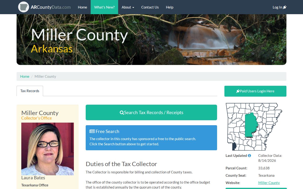
Tax status can confirm the parcel being studied, while the owner and occupant questions still require their own records.
Follow Texarkana Deeds by Street
A deed chain takes the Texarkana street directory back through owners. Start with the current acquisition reference on the parcel card. Obtain that instrument and note grantor, grantee, recording date, instrument number or book and page, and legal description. Search the grantor as an earlier grantee. Repeat while the legal description remains consistent. Grantor means the party transferring an interest; grantee means the party receiving it.
The Miller Circuit Clerk at 400 Laurel Street, Suite 109, is the ex-officio recorder. The office keeps deeds, mortgages, liens, plats, and related instruments. It lists weekday hours of 8:00 a.m. to 4:30 p.m. and phone 870-774-4501. No official online deed-index cutoff is published. When a web trail ends, use the courthouse grantor-grantee index, deed books, phone inquiry, or a targeted copy request. Recording fees do not establish copy fees, so ask the clerk before ordering.
Since July 1, 2025, a person who sells or gives away real property must present valid photo ID under Ark. Code Ann. §14-15-403. The office also runs free property and mortgage fraud notifications.
Voter Files Along Texarkana Streets
VoterView cannot build a street list. Its identity-gated form confirms one known registration and can return polling place, districts, and sample ballot information. A by-street project requires the voter-registration file from the Miller County Clerk or Arkansas Secretary of State. Released fields can include name, residential or mailing address, precinct, district, and last-voted date, subject to the redactions in Arkansas Constitution Amendment 51 §8(e).
The County Clerk offers a paper list at two cents per name or a $50 thumb drive. State instructions provide a separate data-request form and electronic delivery for large files. Vote history only records participation in an election, never ballot choices. Filter a lawfully obtained file by normalized street name, then keep the file date visible. Registrations change, protected fields remain excluded, and a voter row should not be expanded into assumptions about other people at that address.
Practical check. Try full street names and common suffix forms after obtaining the file, but keep the original released text beside any normalized version.
Texarkana Permits Need Requests
No verified public Arkansas-side permit or code-case index, with a documented coverage date, was found in the research. Lead with the fallback. Contact the relevant Texarkana planning, public works, or code office, or send a narrow request through the City Clerk FOIA form. State the full address, department, desired record type, and date range. Arkansas FOIA does not require the city to answer a research question or create a new compilation.
A released permit may show applicant, owner, contractor, parcel, work description, value, issue date, and final date. It is construction evidence. It is not a roll of occupants. Municipal records also depend on city limits. A Texarkana mailing label can extend beyond the incorporated area, while the 2007 and 2017 annexations changed city jurisdiction for some land without necessarily changing postal delivery.
Arkansas FOIA generally requires prompt access during normal hours. A record in active use or storage may be supplied within three working days after the custodian certifies that status.
Historic Texarkana Streets by Address
Printed directories add the resident layer that property records cannot supply. The verified broad Texarkana catalog run spans 1904 through 1960. The Briscoe Center also holds the August 1948 Kriss Kross Directory of Texarkana, U.S.A., a direct address-to-name tool, plus long runs of telephone books. Check each title’s state side because one metropolitan volume can mix Arkansas and Texas residents.
Sanborn fire-insurance maps help when a building footprint, street number, or use changed. Census schedules through 1950 can add household members and relationships. The directory’s occupation and employer can separate two people with the same surname. Full collection years and entry abbreviations belong in the Texarkana city directory; the street search only uses those sources after a parcel or old address is fixed.
Miller County’s unusual history adds another caution. It was created in 1820, abolished in 1838, and re-created in 1874. Very early records can sit outside a continuous modern county series.
Texarkana Address and City Limits
The only current Arkansas-side Texarkana ZIP verified by an authoritative source is 71854. Texas-side 755xx ZIPs should not be sent to Miller County by default. First check the full address through USPS. Then test municipal jurisdiction with Arkansas Check My City and the parcel map. ZIP codes route mail; they do not define counties or city boundaries.
Within Miller County, the 911 Address Authority assigns numbers for new structures and properties at 1,000 address points per mile, with even numbers on the right and odd numbers on the left. Coordinator Travis Loehr is listed at 870-840-8540. This method explains present numbering but does not supply a historic renumbering date. No official complete Texarkana street-renumbering year was found. Bridge old and new references with plats, legal descriptions, directory street guides, and Sanborn sheets instead of inventing one.
Limits of Texarkana Street Directories
A street directory cannot reveal a full current household. Assessment and deed records identify interests in land. They do not establish who sleeps at an address. Voter records cover registered voters and apply statutory redactions. Voluntary HOA, congregation, and block-watch rosters remain private unless their keepers choose to share them. Protected participants in the Arkansas Address Confidentiality Program must not have substitute addresses reverse-engineered through linked records.
Motor-vehicle personal data remains restricted by the federal DPPA. Public assessor data is not a workaround. Sealed court matters, juvenile files, adoption records, and exempt police information also stay closed. Correct errors through the office that holds the record. Recorded instruments need an authorized corrective filing or court process; they are not silently erased.
Lawful street research. Use Texarkana address records for family history, estate work, civic study, fraud prevention, or property curiosity. Never use them to stalk, harass, threaten, or expose a protected person.